


OHA’s Kipuka Database is a geographical information system (GIS) that utilizes the latest mapping technologies to provide a window into native Hawaiian land, culture and history. Kipuka links historic data sets to geographic locations reinforcing the concept of information embedded in the ‘aina (land), encoded in the wahi inoa (place name). The foundation of Kipuka is the traditional land system, mokupuni divided into moku, ahupua‘a, ili and kuleana. A sense of "place" was a foundational aspect of traditional kanaka maoli (Native Hawaiian) identity. This is evidenced by the sheer number of inoa wahi (place names) which were recorded by Native Hawaiians in oral traditions, as well as in books, letters, manuscripts and newspapers. Furthermore, despite historical challenges which have fragmented traditional cultural and historical knowledge, place remains an important part of contemporary Native Hawaiian identity (Kana‘iaupuni 2006, Kame‘eleihiwa, 1992).The mission of Kipuka is to create a repository of knowledge where information about Hawai‘i’s land, culture and history can be easily accessed, to develop a virtual mo‘oku‘auhau of land tenure in Hawai‘i, and to provide an opportunity for individuals to forge new relationships between themselves and the ‘aina (land) that is most important to them.
The Kipuka Map Database Project utilizes ArcGIS Online to display our data. Click on one of the following maps below to see the web map in action.
This map shows the members and term status of the State Burial Councils by region and type

This map shows the location of permitted vacation rentals for the City & County of Honolulu

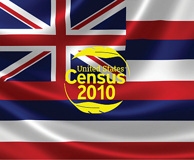
Contains Native Hawaiian population as well as housing, social, and economic characteristics data by Census Tracts and Census Designated Places (CDP) for the 2010 Census and the American Community Survey Selected Population Tables for 2006-2010 and 2011-2015.
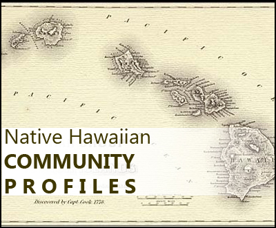
Contains U.S. Census data regarding the 'Native Hawaiian Population Alone' as well as Native Hawaiian Population Alone or in Combination' from the year 2000 in the United States. In the state of Hawaii there is similar data on a census tract level from 2000 and 2010.
This webmap illustrates the 130,000 acre U.S. military Pohakuloa Training Area (PTA) on the island of Hawaii and areas that may be potentially affected by the military's live-fire training exercises and other activities. The map also identifies some (but not all) historic sites and properties in the area.

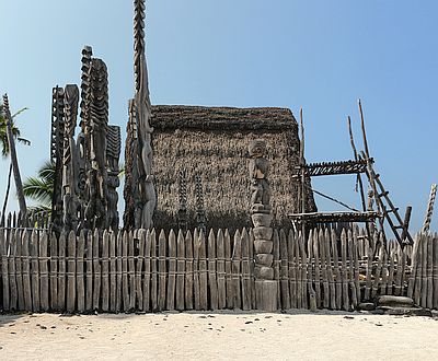
Map illustrates the location of historic Pu‘uhonua (places of refuge, sanctuary, asylum, place of peace and safety) across the Pae ‘Āina
Maps for the Trust for Public Land Hawai‘i Statewide Conservation Planning O‘ahu Greenprint project

The Navigation tutorial explains the multiple ways to move around in the Kipuka database map application. Zoom in an out of the map using your scroll wheel on your mouse; drag a box over an area using the zoom tool or zoom using the slider. Pan by clicking and dragging the mouse, use preset bookmarks or create your own and use the navigation window to quickly move over large areas.
This tutorial explains the layers that are available in the Kipuka map application. It explains how layers function at different extents, how to turn layers off and on and how to view the layer tab in the toolbar. It is important to remember the layers in Kipuka will continue to change, as new data become available, corrections are made and as new functionality is added.
The Tool Bar tutorial discusses the multiple tools available to the Kipuka user. There are tools to measure distance and area, you can select features in a defined location, access street view and scroll between aerial, street and terrain base maps. The tool bar also has a search function, pan, zoom and click to identify buttons.
This tutorial explains how the search function in Kipuka works. You can search using place names, family names, TMK and land award numbers. It also explains how results are displayed, what details are, and links to maps, documents and the Papakilo database.

Video tutorials can be accessed by clicking the “Tutorial” tab in the upper right hand corner of this page. PDF factsheets, how to guide and in depth reports on Kipuka can be found using the “About” tab. Email questions, concerns and recommendations to kipukainfo@oha.org or call the Office of Hawaiian Affairs at (808)594-1835.
OFFICE OF HAWAIIAN AFFAIRS
560 N. Nimitz Hwy., Suite 200
Honolulu, HI 96817
Phone: (808) 594-1835
Fax: (808) 594-1865
Email: kipukainfo@oha.org
![]()
The maps and map data are provided "as-is" and are not legal surveys or legal descriptions. The Office of Hawaiian Affairs explicitly disclaims any representations and warranties as to the accuracy, timeliness, or completeness of maps and data. These maps and data are created from multiple city, county, state and federal sources, and the source data may contain errors. These maps and data should not be used for navigational, tracking, or any other purpose requiring exacting measurement of distance or direction. In no event will the Office of Hawaiian Affairs or its officers or employees be liable for any losses or damages that might arise from the use of the maps and data. The Office of Hawaiian Affairs shall assume no liability for any decisions made or actions taken or not taken by the user of the maps and data. As it relates to these maps and map data and to the greatest extent permitted by law, all immunities and privileges provided by Hawaii common law are applicable and fully reserved by the Office of Hawaiian Affairs.
![]()
![]()